By Nippon With Me EditorialPublished Updated
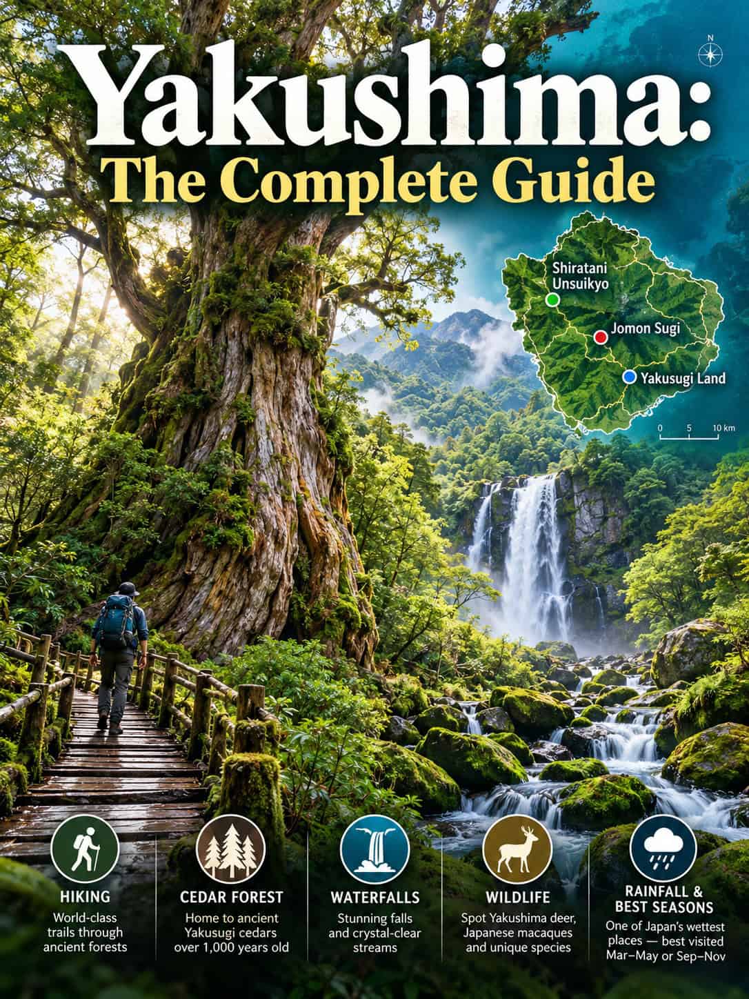
This Yakushima travel guide explains how to explore the UNESCO-listed island south of Kyushu, from the ancient Jomon Sugi cedar and mossy Shiratani Unsuikyo to Yakusugi Land, waterfalls, tidal hot springs and turtle-nesting beaches. Compare ferries and flights from Kagoshima, hiking times, bus options and car rental. Important: storm damage in September still restricts some Shiratani Unsuikyo trails. Coming from Fukuoka? The island works well as a nature add-on to a southern Kyushu trip.
Yakushima Travel Guide: Essential Planning Facts
| Category | Details |
|---|---|
| Best for | Ancient cedar forests, a UNESCO World Heritage landscape, a tidal hot spring, and sea turtle nesting beaches |
| Ideal trip length | 3–4 days for hikers, including a weather buffer; 2–3 days for gentler sightseeing |
| Getting there | High-speed jetfoil or plane from Kagoshima, plus limited slower ferry options; check vessel cancellations before booking |
| Getting around | Local buses to major trailheads, or a rental car for full flexibility |
| Best time to visit | Spring and autumn often suit hiking, but rain occurs year-round. Typhoons can affect travel from summer into autumn; verify road and trail closures. |
| Currency | Japanese yen (¥) |
Yakushima Travel Guide: Trail Status After the September Typhoon
| Area | Status following the typhoon | Important detail |
|---|---|---|
| Yakusugi Land | Reopened September 16 | Approach road uses regulated one-lane traffic after repairs |
| Jomon Sugi, Arakawa route | Accessible from September 17 | Arakawa shuttle rules still apply |
| Miyanoura-dake via Yodogawa | Access restored September 17 | High-mountain conditions can still cause closures |
| Shiratani Unsuikyo | Reopened October 18, restricted paths | Road has alternating one-way traffic; some trails remain closed due to landslides and fallen trees |
| Coastal waterfalls, onsen and villages | Generally operating normally | Verify individual providers and weather |
Conditions change quickly. Before any hike, check the latest trail notice from the recreation-forest operator and the town office, and do not take “park reopened” to mean every course is passable.
Yakushima Travel Guide: UNESCO Forests and Nature
Yakushima became one of Japan’s first Natural World Heritage Sites in 1993, recognized for old-growth forests that run from subtropical vegetation near the coast up through warm-temperate and cool-temperate zones on the island’s mountainous interior — a vertical compression of climate zones rare for such a small island. The designation protects the yakusugi, native Japanese cedars that can live for thousands of years in these conditions, along with the ecosystem that depends on them.
Where to Stay in Yakushima: Miyanoura vs Anbo
Miyanoura
Miyanoura is a major port and accommodation area with shops, restaurants and bus links toward Shiratani Unsuikyo. Some high-speed vessels instead arrive at Anbo, so check the port printed on your ticket before booking a hotel or transfer.
Anbo
Anbo is convenient for eastern island sightseeing and the Yakusugi Museum, where the seasonal Arakawa mountain shuttle for Jomon Sugi begins. Other buses serve Yakusugi Land and Kigensugi, subject to infrequent timetables. The Arakawa trailhead itself is not a normal public-road stop for rental cars during regulated months.
Things to Do in Yakushima: Hikes, Waterfalls and Hot Springs
Yakushima Hiking: Trail Comparison for First-Time Visitors
| Route | Typical time | Who it suits |
|---|---|---|
| Yakusugi Land short circuit | About 30–50 minutes | Beginner forest walk, subject to conditions |
| Yakusugi Land longer trails | About 80, 150 or 210 minutes | Walkers comfortable with uneven forest terrain |
| Shiratani Unsuikyo short routes | Varies, often 1–2 hours | Short moss-forest walks, only on reopened paths |
| Shiratani Unsuikyo to Taikoiwa | Often about 4–5 hours return | Stronger hikers; check current closures |
| Jomon Sugi via Arakawa | About 9–11 hours return | Experienced, fit hikers with early start |
| Miyanoura-dake | Full mountain day or longer | Experienced mountain hikers; weather-dependent |
Times are approximate and exclude prolonged stops. Mud, rain, landslides and trail maintenance can alter difficulty. Do not enter any signed closed section, even if an older online map shows a through route.
Things to Do in Yakushima Without a Long Hike
Choose an open short Yakusugi Land loop, see Kigensugi near the road, visit Ohko-no-Taki waterfall, explore Anbo’s river and local shops, or time Hirauchi Kaichu Onsen to low tide. In turtle nesting season, use approved guided activities rather than walking restricted beach sections at night.
Jomon Sugi
Jomon Sugi is a demanding full-day hike, typically 9–11 hours return from the Arakawa trailhead. During March 1–November 30, most visitors must take the dedicated mountain shuttle from Yakusugi Museum; ordinary private cars cannot reach the trailhead on the regulated road. Start before dawn, check the last shuttle, and carry proper waterproof hiking gear, food and a headlamp. Estimates of the tree’s age range from approximately 2,000 to 7,000 years depending on the method, so no single figure should be treated as settled. It is viewed from a protected platform, not approached or touched.
Yakushima Hiking to Jomon Sugi: Arakawa Shuttle
From March 1 to November 30, private vehicles are restricted on the road leading to the Arakawa trailhead. Board the mountain shuttle outside Yakusugi Museum near Anbo, buy your ticket in advance at the Yakusugi Museum bus stop, the tourist information centers in Miyanoura, Anbo and at the airport, or at some accommodations. The fare is ¥700 one way or ¥1,400 round trip for junior high school students and adults, and ¥350 or ¥700 for elementary school students. Departures begin very early in the morning, and returns are typically afternoon services, so do not miss the final shuttle. Seats are generally not reservable. The road restriction applies around the clock, so a pre-dawn drive up in a rental car is not possible; chartered buses and taxis are exempt.
Yakushima also requests a voluntary Mountain Environmental Conservation Fund contribution, which is separate from the bus ticket: ¥1,000 per person for a day in the mountains and ¥2,000 for an overnight trip, payable at the same tourist information centers or at the office in front of the Yakusugi Museum when you buy the bus ticket.
Jomon Sugi Trek: Section Times and Facilities
| Section | Walking time one way | Cumulative |
|---|---|---|
| Arakawa trailhead to Kosugidani rest area | 60 minutes | 1 hour |
| Kosugidani rest area to Kusukawa branch | 30 minutes | 1 hour 30 minutes |
| Kusukawa branch to Kosugidani toilet | 5 minutes | 1 hour 35 minutes |
| Kosugidani toilet to Okabu trail entrance | 65 minutes | 2 hours 40 minutes |
| Okabu trail entrance to Wilson stump | 35 minutes | 3 hours 15 minutes |
| Wilson stump to Odaisugi | 45 minutes | 4 hours |
| Odaisugi to Jomon Sugi (1,280 m) | 40 minutes | 4 hours 40 minutes |
The return takes about the same, so the walking alone adds up to roughly 9 hours 20 minutes before any breaks. The first stretch follows an old trolley track of about 8.5 km, and the climbing trail is about 2.5 km each way. Toilets are at the Arakawa trailhead, Kosugidani, the Okabu trail entrance and Takatsuka hut, with portable booths at Odaisugi. From March to November about 160 cars can park at Yakusugi Nature Museum, where the shuttle starts and takes about 35 minutes to the trailhead. From December to February about 20 cars fit at the Arakawa trailhead itself, roughly 40 minutes by car from Anbo.
Shiratani Unsuikyo
Shiratani Unsuikyo is known for lush mossy forest, old cedars and routes toward the Taikoiwa viewpoint. Following the September typhoon damage, the approach road reopened with alternating one-way traffic on October 18, and the park reopened with only selected trails accessible. Do not assume every route, or the long connection to Jomon Sugi, is currently open. Check the latest trail notice before visiting; entry costs ¥800 for high school students and adults.
Yakusugi Land
Yakusugi Land has several marked walks through cedar forest, from an accessible short circuit of roughly 30–50 minutes to longer mountain paths of approximately 80, 150 and 210 minutes. The longest forest routes are not equivalent to climbing Tachudake summit, which requires a separate substantial mountain hike. The park reopened after the September storm on September 16, but always confirm local road and trail conditions. Entry costs ¥800 for high school students and adults.
Ohko-no-Taki Waterfall
Ohko-no-Taki is an 88-metre waterfall on Yakushima’s southwest coast and one of Japan’s celebrated waterfalls. It is reachable by road and a short approach from designated parking, but wet rocks near the plunge pool are slippery. The drive time depends on your starting point and the island’s winding roads, so verify the route instead of relying on generic times.
Hirauchi Kaichu Onsen
Hirauchi Kaichu Onsen is a tidal, open-air hot spring exposed only around low tide, generally within about two hours either side. The bath is communal and mixed-gender, with traditional no-swimsuit rules; confirm posted covering and payment rules on arrival. Bring coins and consult local tide tables and sea conditions. High swell can make a low-tide visit unsafe or impractical.
Nagatahama Beach and Sea Turtle Nesting
Nagata’s beaches are a significant North Pacific loggerhead nesting area. Nesting and hatching seasons vary by year and site; protected beaches enforce nighttime access, light and photography restrictions during the breeding season. Check current conservation notices and approved visitor programmes, as tour availability and dates differ between beaches.
Kigensugi
Kigensugi is an ancient cedar reached from a roadside viewing area via the Yakusugi Land/Kigensugi mountain road rather than the regulated Arakawa trailhead road. It is useful for visitors unable to make the full Jomon Sugi hike, but bus departures are limited and mountain-road access depends on conditions.
Choosing a Base: Quick Summary
Miyanoura is the most convenient base for ferry arrivals and for reaching Shiratani Unsuikyo.
Anbo puts you closer to Yakusugi Land and the Arakawa Trailhead for Jomon Sugi, useful if an early hiking start matters.
How to Get to Yakushima: Flights, Jetfoils and Ferries
From Kagoshima, high-speed Toppy/Rocket jetfoils connect to Yakushima’s Miyanoura and/or Anbo ports, with route duration commonly around two to three hours. Japan Air Commuter flights take roughly 40 minutes from Kagoshima Airport. Fares change, so check live prices when booking. Slower car-ferry sailings have been limited in recent years; confirm that a service is actually operating before planning around it. Most international visitors only need to check entry requirements for Japan itself, as no separate permit is needed for the island.
How to Get to Yakushima from Kagoshima
| Transport | Journey | Planning note |
|---|---|---|
| JAC flight, Kagoshima Airport → Yakushima Airport | About 40 minutes airborne | Variable fares; allow time between airport and ferry port if changing modes |
| Toppy / Rocket jetfoil, Kagoshima Port → Yakushima | About 2–3 hours | Check exact arrival port: Miyanoura or Anbo |
| Slower car ferry | Around four hours when running | Limited service; confirm sailings with the operator |
| Ferry via Tanegashima | Much longer, connection-dependent | Check the actual sailing timetable and overnight arrangements |
A shuttle bus from Kagoshima Airport to the high-speed ferry terminal takes about 55 minutes, and from Kagoshima Chuo Station the terminal is about 20 minutes by bus or 15 minutes by taxi. Allow a generous interchange buffer and a spare travel day when possible because heavy seas and storms can cancel boats or flights.
The jetfoil leaves from Kagoshima Honko port (Minami-Futo) for Miyanoura or Anbo. The crossing takes about 1 hour 50 minutes to 3 hours depending on whether the boat also calls at Tanegashima or Ibusuki, and there are six sailings a day, varying by season. The car ferry Yakushima 2 uses a different terminal about a seven-minute walk away, sails once a day directly to Miyanoura in about four hours and carries cars and motorbikes. The cheapest crossing is the Hibiscus, which takes about 13 hours with an overnight stop at Tanegashima. Flights from Kagoshima run several times a day, with one flight a day each from Fukuoka (about 70 minutes) and Osaka. Flights are less affected by weather than boats, so on the morning you travel, look up the cancellation status of your crossing.
Compare flights into Kagoshima and Yakushima. Compare Japan eSIM data plans before travelling into remote mountain areas.
Yakushima Travel Guide: Local Buses and Rental Cars
The island’s main buses connect coastal settlements and selected forest routes, while a second operator serves additional routes. Multi-day bus passes exist for the main routes but exclude the separate Arakawa mountain shuttle, so check current pass prices and coverage with the operator before buying. Local buses serve some trailheads but can be very infrequent, with services to forest destinations sometimes running only a handful of times daily. A rental car helps with waterfalls and onsen; however, from March to November you still need the authorized Arakawa shuttle or other permitted transport for the Jomon Sugi trailhead. Check the official road status before driving mountain routes.
Yakushima Transport: Bus Pass vs Rental Car
| Option | Best for | Limitation |
|---|---|---|
| Main island bus pass | Coastal villages and selected forest routes | Eligible main routes only; check current prices |
| Arakawa Mountain Bus | Jomon Sugi trailhead access from Yakusugi Museum | Separate ticket; not covered by island bus pass |
| Rental car | Waterfalls, coastline and flexible timing | Not a substitute for the Arakawa shuttle; roads on the western side are narrow |
| Taxi or guided tour | Short stays and early starts | Book ahead; availability is limited |
Buses to forest attractions may be infrequent, so plan return times carefully and keep a buffer for the last departure.
Best Time for Yakushima Hiking and Wildlife
Spring and autumn can offer more comfortable hiking temperatures, but Yakushima receives substantial rain throughout the year. June is typically among the wettest months and tropical storms can disrupt transport from summer into autumn. This year’s September typhoon damage affected multiple forest roads, showing why season-based recommendations must always include checking current access notices. Mountain temperatures can be markedly lower than coastal conditions even in warm weather. For the wider picture of Japan’s seasons, see our best time to visit Japan guide.
If It Rains on Yakushima
Rain shuts roads here. The Shiratani Unsuikyo Miyanoura Line, Yakushima Koen Anbo Line, Seibu-rindo Forest Path, Arakawa Line and Yodogawa Line can all close for rain, typhoons, or snow and ice, and when the Yakushima Koen Anbo Line closes, the Arakawa Mountain Bus to Jomon Sugi is cancelled as well. Local buses to Shiratani Unsuikyo and Kigensugi can be suspended, jetfoils and ferries may be cancelled or cut back, and in bad weather the jetfoil may arrive at Miyanoura instead of Anbo. Mountain rain also brings sudden flash floods: do not cross a swollen creek on a trail, and wait for the water to drop or turn back. Designated swimming beaches close in bad weather, so ask locally before going. Keep a spare day before your departure so that a cancelled shuttle or boat does not cost you the Jomon Sugi trek.
Yakushima Travel Guide: 3-Day Itinerary
Day 1: Arrive by plane or jetfoil, check the operator’s current trail-closure bulletin, and walk only an officially open short route at Shiratani Unsuikyo if arrival time and weather allow. Otherwise visit Miyanoura or the coast.
Day 2: Take the pre-dawn Arakawa mountain shuttle and hike approximately 9–11 hours to Jomon Sugi if experienced and conditions permit. Otherwise choose an officially open 30–150-minute Yakusugi Land circuit.
Day 3: Visit Ohko-no-Taki and other accessible coastal sights; time Hirauchi Kaichu Onsen strictly around the day’s low-tide window, sea state and posted rules. Allow enough time to reach your confirmed departure port or airport.
Yakushima Travel Guide: Three or Four Days?
| Day | Plan | Weather alternative |
|---|---|---|
| 1 | Arrive, settle in Miyanoura or Anbo, short open forest walk | Museums, town exploration, cafes |
| 2 | Jomon Sugi from Arakawa for experienced hikers | Short Yakusugi Land walk if mountain conditions permit |
| 3 | Coastal waterfall and tidal onsen | River area, shops, relaxed coastal day |
| 4, recommended buffer | Second forest visit or delayed boat/flight | Rescheduled travel after poor weather |
Three days work if flights and conditions cooperate. Four days improve your odds of fitting in at least one major hike, particularly during rainy or typhoon-affected periods. Avoid booking a Jomon Sugi trek on your departure day.
Where to Stay in Yakushima for Hiking
Anbo: Convenient for early Yakusugi Museum access and the Arakawa shuttle. Miyanoura: Useful for shops, arrivals and northern forest routes. South coast: Quieter, nearer tidal hot springs but with fewer public transport options. Verify whether your jetfoil lands in Anbo or Miyanoura before selecting accommodation.
Browse guided Yakushima hiking and island experiences. Check whether an offer includes mountain shuttle fares or conservation contributions.
Yakushima’s Wildlife
Yaku macaques and Yaku deer are characteristic wildlife of Yakushima, especially on forest roads and in quieter wooded areas. Do not feed wildlife, approach young animals or stop abruptly in the road for photographs.
Food on Yakushima
Flying fish (tobiuo) shows up across the island in dishes from sashimi to deep-fried tempura, often considered the signature local catch. Fresh seafood generally is a strength here, given the island’s isolation and surrounding waters, alongside sweet potato-based shochu distilled locally. The island is also known for ponkan and tankan, two citrus varieties grown in its warmer coastal areas, sold fresh or turned into juices and sweets in Miyanoura and Anbo.
Practical Tips for First-Time Visitors
Pack waterproof jacket and trousers, suitable hiking boots, warm layers, food, water, a torch and offline maps for longer treks; our Japan packing list covers the basics. Mobile coverage is patchy in the forest, so set up a data plan before you go (see eSIMs and SIM cards for Japan). Check mountain-weather alerts, park notices, road access and the Arakawa shuttle timetable on the day. Carry your rubbish out, use designated mountain toilets and do not cross trail barriers. Hirauchi Kaichu Onsen is a tidal site, not an all-day spa.
Frequently Asked Questions
How do I get to Yakushima from Kagoshima?
Jetfoil services commonly take about two to three hours depending on stops; flights from Kagoshima take roughly 40 minutes. Verify prices and schedules with the operator, and confirm whether the slower car ferry is operating before planning around it.
How old is Jomon Sugi really?
It is genuinely ancient, but the exact number is disputed: estimates range from roughly 2,000 to 7,000 years depending on the method. Treat any single precise figure with caution.
Do I need a car on Yakushima?
Not strictly. Buses reach selected forest sites, but frequencies are limited. From March through November, rental cars cannot drive to the Arakawa trailhead under the standard regulation; use its mountain shuttle or authorized transport.
When can I see sea turtles nesting on Yakushima?
Loggerhead turtles come ashore at night during the nesting season, from spring into summer, with hatching following into late summer. Night access to the nesting beaches is restricted and rules vary by beach and season, so check conservation notices and approved programmes.
When is low tide at Hirauchi Kaichu Onsen?
It varies daily — the baths are usable for roughly two hours either side of each of the two daily low tides, so check tide times for your specific visit date rather than a general rule.
What’s the best time to visit Yakushima for hiking?
Spring and autumn may offer comfortable temperatures, but rain can occur in any month and typhoons may disrupt access into autumn. Check seasonal forecasts and the current trail bulletin.
How long does the Jomon Sugi hike take?
It commonly takes 9–11 hours return from the Arakawa trailhead, with long walking sections and uneven, wet mountain terrain. It is best for fit hikers with early transport arranged, and the longer approach via Shiratani Unsuikyo takes more time and depends on current trail openings.
When did Yakushima become a UNESCO World Heritage Site?
1993, as one of Japan’s first Natural World Heritage Sites, recognized for old-growth forests spanning subtropical coastal vegetation up through cool-temperate mountain forest in a small area.
Is Shiratani Unsuikyo open right now?
It reopened on October 18 following typhoon damage, but some trails remain closed and the access road uses alternating traffic. Consult the current official trail bulletin.
How much is the Arakawa mountain shuttle?
It is a separate ticket from the island bus pass, bought near Yakusugi Museum. The fare is ¥1,400 round trip (¥700 one way) for junior high school students and adults and ¥700 round trip for elementary school students; a voluntary conservation donation of ¥1,000 per person for a day hike or ¥2,000 for an overnight trip is also requested.
Is the slower Yakushima car ferry operating?
Ferry Yakushima 2 is listed with one direct sailing a day from Kagoshima Honko port to Miyanoura, taking about four hours and carrying cars and motorbikes, and the Hibiscus takes about 13 hours with an overnight stop in Tanegashima. Both are more affected by weather than flights, so confirm the sailing on the morning you travel.
What are the best things to do in Yakushima without hiking?
Visit Ohko-no-Taki, Kigensugi if road access permits, Anbo, the coastline and Hirauchi Kaichu Onsen around low tide. Respect turtle beach restrictions.
How many days do you need on Yakushima?
Allow three days for a short visit or four days for a serious hike plus a weather buffer.
Is Yakushima safe to hike alone?
Some short, open routes may suit solo visitors with suitable preparation, but long mountain hikes require navigational ability, reliable equipment, weather checks and a submitted mountain-climbing notification. A local guide is useful for unfamiliar conditions.
Bottom Line
Yakushima rewards visitors who plan around forest conditions, limited transport and heavy rain. Choose accessible hiking routes for your ability, allow an extra weather day and confirm which trails are open before taking a boat or flight to the island. If you want another subtropical island next, see our Okinawa guide.